Tuesday 4 October 2016

Days 92-94 (3-5 Oct) In Closing - Clear Across the Country

Homeward bound, at a great rate of knots, with gale force winds on our tail and threats of rain and flash flooding in our path eastwards.

Enjoying a long hot shower at Ceduna, and listening to the classic hits radio station playing in the amenities, the sentimental country songs gave me pause for reflection and not a little nostalgia for John Denvers’ Take me home… country roads… (if you don’t know what this is, I’m officially old).

Yes, our 13 weeks (a bit more, actually) is drawing to a close and it is starting to sink in that we’re heading home and back to the routines and craziness of normal life. Let’s face it, we haven’t had this much time off since … well… probably the summer before we commenced kindergarten sometime last century. And probably won’t again until … well … possibly retirement. A goal post which the government keeps shifting, I might add.

We always wanted to spend three months travelling around Australia, but it always seemed a far-off pipe dream. But as Dave always says “you just have to set the date or it will never happen”. We did set a date – for 2015. Then I broke my legs in 2014 and we decided to put our dreams on hold for another 12 months. Which was kind of a relief because we felt very unprepared anyway, but as the actual date approached – mid-2016 – we felt just as unprepared. We did manage to buy ourselves a caravan five months before the big trip, and even fitted in a couple of shakedown weekends away.

Things hit unprecedented levels of craziness in the weeks before our departure, and actual planning for the trip seemed last on the list of things to do. In the end, Dave drafted a rough timetable, I threw in enough food for 2 weeks, and we hit the road, saying over and over as a protective mantra “if we need anything else we can buy it as we go”.

Yes, there were some teething issues in the form of medical and mechanical mayhem that first week or two, but we tightened the saddle and lurched determinedly forwards. Despite the now infamous incident of the caravan bumper falling off, this little van has been well suited to our trip. We’ve been the envy of some folk who opted for a camper-trailer and then had to contend with the elements, flies and mosquitoes when cooking, not to mention the rain, wind and cold down the west coast. We’ve even hosted a few caravan tours on request in various places (they don’t take very long).

Our journey home has not been uneventful. South Australia had just been hit with its worst storm in 50 years and there were many ramifications, not least the state-wide blackout. In the spirit of Oscar Wilde I would have to say that to lose one region may be regarded as a misfortune; to lose the whole state looks like carelessness. At the township of Kimba, the “halfway point across Australia”, there was still no electricity nearly a week after the big storm, so all shops were shut. Travelers from further east told of being stuck in various towns where they could not withdraw money or buy food, and the fuel station pumps would not operate without power. When the electricity goes, most shops simply don’t open at all, although I heard there were some exceptionally good specials on meat and dairy products in some places (if you had cash).


To make life even more interesting, a second storm front came through a few days later, and flood waters continued to rise in various places. We also knew we didn’t have quite enough fuel to make it right across the State of SA, which was becoming a slight concern. At Port Augusta Dave squeezed the last drops out of the diesel pump at the Shell servo. Many of the other fuels had already run out, as tankers cannot get through from Adelaide to replenish supplies due to the floods. The guy waiting behind us to refuel had to be turned away. 

At a roadhouse east of Port Augusta we saw an interesting advertisement: "Camel Milk – Humpalicious!" I don't know if they were serious; I can't imagine who would be brave enough to milk a cantankerous camel. Perhaps this is a local euphemism for a caramel milkshake?

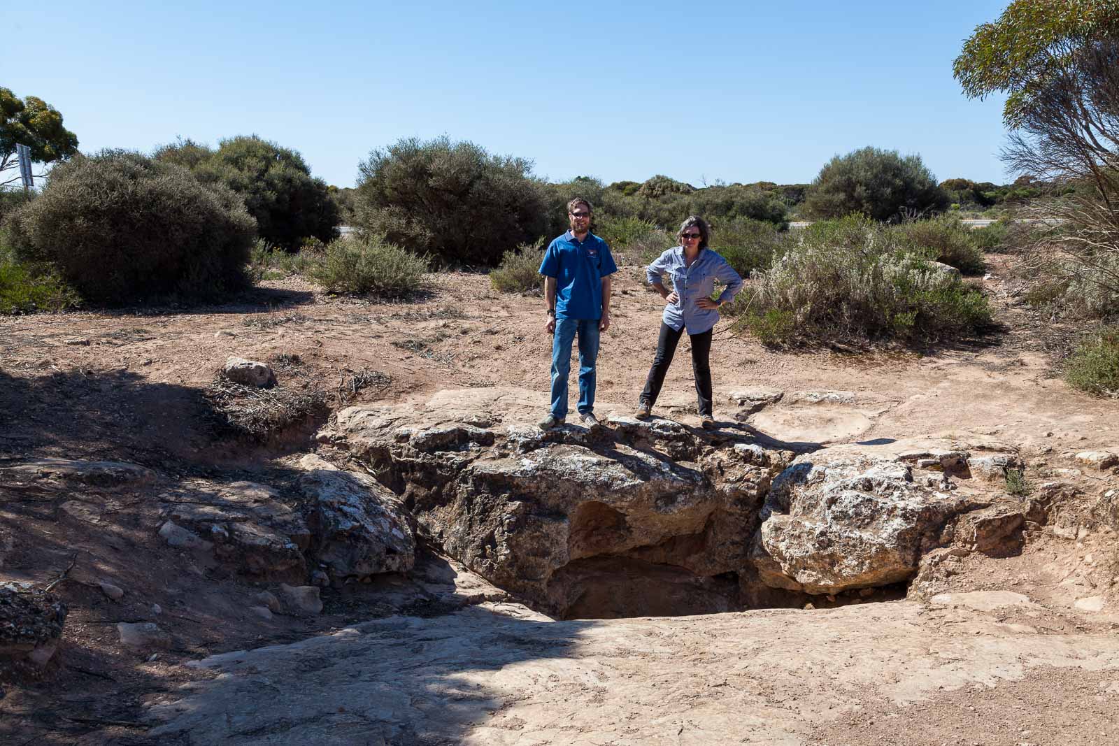
We enjoyed a long lingering lunch in the historic township of Burra after we kind of got distracted in the Town Hall when we discovered some old costumes in the dressing rooms behind the stage with an invitation to "dress-up!" Well, why not. We never pass up a photo op. 

East of Morgan, there appeared to be a creature of most peculiar appearance stretched across the width of the highway ahead - it stood quite tall with a long humpy body and many legs, like a giant mutant king-kong of a caterpillar. As we drew closer we were delighted to discover it was a mother emu with 4 adolescents trailing after her. We pulled over to take a closer look, but mother emu immediately moved in front of her young and stared us down. We made the strategic decision to stay in the car, rather than putting on a sideshow for passing motorists of Dave being chased by a mother emu.


We made it through to Renmark, just west of the Victorian border, and were able to refuel there before stopping at a rest area for some late afternoon tea and a quick leg stretch. Large amounts of water were evident on the roadsides, but it had mostly receded from the highway. Hopping back into the car, we were a little stunned to hear a description of our rig and location being broadcast on the short wave radio. Yes, we were trying to flee the State of SA with its lack of power and fuel, but did not think that warranted fugitive status. Though still not entirely sure what this was about, we assume a passing authority was reporting us for being stopped in an area where caravans are not permitted to park overnight. Personally, I think we are the least of their concerns at present. We hit the road again and made it to the relative safely and security of Victoria.

Little did we know things were about to get more exciting in NSW. There was a lot of water near the road on the Hay plain, increasing as we headed towards Narrandera. Then really increasing. Until there was water over the road. And then a lot of water over the road. Traffic controllers were letting only one lane through at a time, with the waters still rising. The highway to our east was still open when we came through, but may not be for much longer. Highways in most other directions have already been cut, including through to Melbourne on the Newell Hwy and alternate routes home via the Griffin Way and Lachlan Valley Way. As we neared Wagga we saw a police boat being towed back towards Narrandera. It's not every day you see police boats on the Sturt Hwy! All around us paddocks have turned into lakes, with pelicans swimming serenely past sheep making their way to higher ground. We are running two days ahead of schedule, which is just as well - we may not have made it through tomorrow.

So here we are, having almost completed our three month loop. In fact by the time you read this, we are most likely home. All that remains is to share some of our last highlights and lowlights. 

Low point of the trip: The first week - Dave’s staph infection and knee injury rendering him lame, with both of us suffering heavy colds (his infected toes are finally recovering, but still require regular application of medical creams to keep re-infection at bay).
High point of the trip: The last 12 weeks of the trip.

Dave’s most loved region: The Bungles, Kimberley Region
Liz’s most loved region: Windjana Gorge, Kimberley Region

Dave’s worst regret: Not buying that replacement D-shackle in Wyndham.
History: back in the Bungles, a passing tourist noticed that one of our D-shackles was missing its pin. Dave saw a replacement in Wyndham, but did not buy it, thinking it was the wrong size. We made do with a grossly oversized one we had with us, and we kept looking for places to purchase a replacement, which were few and far between. When he finally found what he thought was the correct size, Dave discovered he had been wrong all along - the Wyndham one would have been perfect, and now we couldn't find another that size. He's consequently developed a tic where he blurts out at random times "Should've bought that D-shackle in Wyndham!"


Liz’s worst regret: Not purchasing hiking poles sooner. I finally bought some in Exmouth, but not until after I'd fallen down Mt Bruce into a spinifex bush. A bit like closing the stable door after the horse has bolted. I have now developed an unreasonable phobia of desert grasses and won't walk past them without clenched fists. I think the last of the spikes have now worked their way out of my hands.

Dave’s favourite purchase: Tuppy the Tortoise in Shark Bay 
Liz’s favourite purchase: T-shirt with Renoir’s “The Boating Party” print in Broome

Favourite meal: Unanimous – the Mornington Wilderness Camp dinner. Especially Dave’s chocolate brownie. Pricey but worth it.

We pause here to consider some of the stats for those so interested.

Cheapest fuel:
 113.9 cents per litre at Albany on 25 September.
Most expensive fuel: 209.0 cents per litre at Drysdale Station, off the Kalumburu Road on 30 July
Best fuel efficiency: 12.65 litres p/100k Pemberton to Albany 
Worst fuel efficiency: 19.5 litres p/100k; Coober Pedy to Marla in a headwind
Total kilometres travelled: 20,011

In closing, many thanks to Dave for his spectacular photographic contributions to the blog, and for being my tireless editor and phrase contributor. He is much funnier than I am. Thanks to our readers for your comments both publicly and privately, and for following our exploits. It has been a pleasure.

This is Tex (AKA Big Red) & the Bumperless Starcraft Outback signing off.

I was always knew he was a gentleman (Town Hall, Burra)
Sunset, Ceduna (Dave)

Australian Farmer sculpture, Widunna (Dave)

The Big Galah, Kimba

No, not open. No power. Kimba, 3 Oct 16 (Dave)
Roadways west of Narrandera, 5 Oct 2016 (Liz)

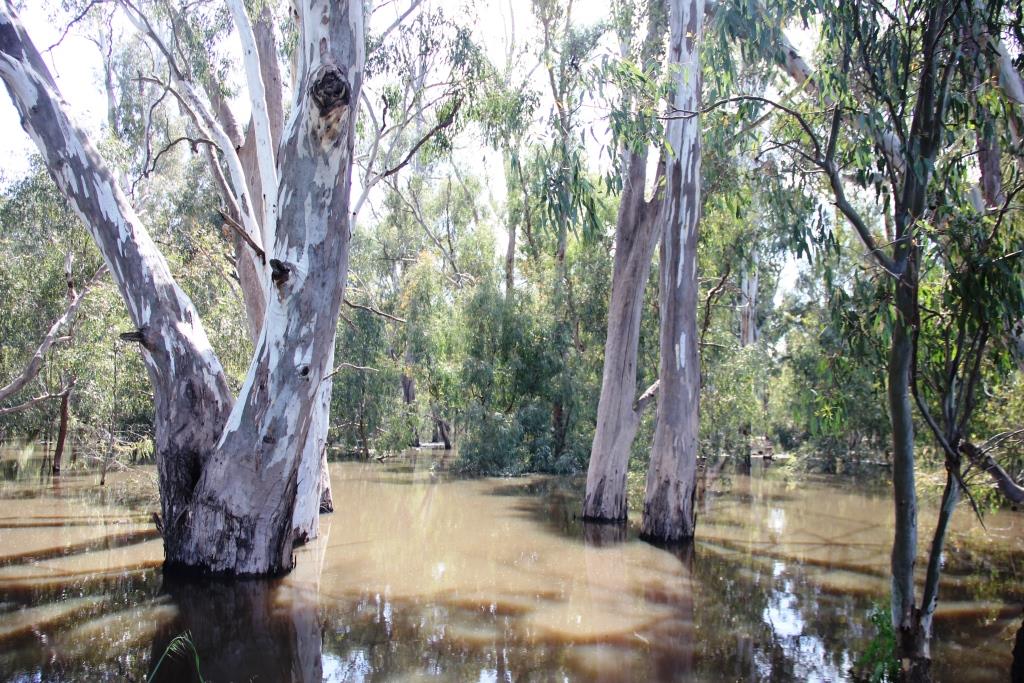
Murrumbidgee River west of Narrandera, well outside its jurisdiction, 5 Oct16 (Liz)

"Water Over Road" at Narrandera, 5 Oct 2016 (Liz)

Truck parking area at the Narrandera Roadhouse, 5 Oct 2016 (Liz)
Truck westbound from Narrandera on the Sturt Hwy, 5 Oct 2016 (Liz)
Tuppy the Tortoise trying to convince Dave not to go home yet (Dave)
PS - One last footnote...
First photo of the trip - Murrumbateman, 4 July 2016
Last photo of the trip - Murrumbateman, 5 October 2016

Monday 3 October 2016

Days 89-91 (30 Sep -2 Oct) Middle of Nowhere on the Nullarbor

We have to be home in a week! Eeek! My boss has been getting a little nervous looking at our tracker and noting we still have to cross the entire country west to east to get home (to be fair, we’ve been procrastinating); four states and four time zones to be exact, at least 3,000km. To confuse things, daylight saving starts this weekend in some states. We're losing time every day across the Nullarbor just from moving east. Even my laptop has no idea of the current time zone – but since it is running Windows 10, I guess that comes as no surprise. We might just drive until we hit home and ask the time there.

We have now hit the Nullarbor – that infamous stretch of bitumen that is the only sealed road for at least 1,200km right across the bottom of Australia. Scrub desert to the left of us, ocean to the right, we're singing "stuck here in the middle with you". The only other suitable song for this stretch might be “Shut up and drive”. No matter how remote or empty, we have discovered that every single place we visit has its own claim to fame – the oldest, largest, tiniest or highest (in the world) something-or-other. The Nullarbor is no different, boasting the longest, straightest stretch of road in Australia – the “90 Mile Straight”. The sign is the only photo op for … well… probably at least 90 miles. Yes, of course we got a picture.

Longest straight road in Australia! (Dave)

Yep, that's it. (Dave)

Our first Nullarbor fuel stop was the Caiguna Roadhouse, where the large greeting sign at the door says “Don’t ask for water as refusal often results in offence”. It is every man for himself out here, self-sufficiency being the key to survival. Fuel is only $1.63 per litre, but water is priceless. Often the only place to sleep is a patch of dirt on the side of the road. Stopping before dusk is also crucial, unless you want to have a head-on with a kangaroo, emu or even a camel. This is not such an issue for the road-trains which roar on through the night collecting stray animals as bumper stickers. Apart from the occasional fuel stop, the only meaningful human contact we are likely to have out here will be at the border quarantine checkpoints where they search us to confiscate fruit and vegies. Friendly, aye.

The listed point of interest on the first day of the Nullarbor crossing was the Caiguna Blowhole, described as a “worthwhile diversion to a unique blowhole”.  We’d agree that it is unique, but the ‘worthwhile diversion’ bit is up for debate. It is a hole in the ground, through which the wind blows from an underground cave. More interesting is the fact that there is a veritable maze of cave passages under the Nullarbor, weaving for miles between larger underground caverns, a whole secret world most of us will never see.
Caiguna Blowhole (Dave)
The next day we stopped at Eucla to view the old telegraph stations ruins, slowing sinking in the sands of time, literally. If you continue down to the beach, you will come across the remains of a very picturesque old wooden jetty, about which photographer Dave was most excited.
Eucla Telegraph Station ruins (Dave)

Eucla old jetty

By Saturday evening we reached Nullarbor itself – a roadhouse – which presented endless photographic opportunities in the form of the quirky and quaint. Even light planes stop here to refuel at the pumps. I reckon the people who live and work here see some interesting things. I'd like to live here for one year to collect stories from people passing through. Dave is most amenable to the idea.

Nullarbor proper sits in the middle of the Treeless Plain, a self-explanatory stretch of road. Make sure you've been to the toilet before hitting this stretch.

Treeless Plain (Dave)
Nullarbor Roadhouse (Dave)

Old cart at Nullarbor Roadhouse (Dave)

Nullarbor Roadhouse, sunset (Dave)

Roadsign, Nullarbor Roadhouse (Dave)

Read the sign on the wall above right. Were there unhelmeted cyclists who did the ride? (Dave)

"Free Spring water" (Dave)

False advertising special (Dave)

Original Nullarbor roadhouse still standing (Dave)

Sunday we reached the Head of the Great Australian Bight – that highest southern point of Australia. Southern Right whales nest in these waters each winter, and we spotted several mummies and their calves just off the coast.The Bight itself is truly spectacular - over 200km of 80m high sheer cliffs stretch along here. The sand is pushed upwards from east and west, culminating in huge sand dunes at the head of the Bight. The sky was white above the dunes this day due to the gale force winds, much sand becoming airborne.

Great Australian Bight cliffs (Dave)


Southern Right whale, Great Australian Bight (Dave)

Head of Great Australian Bight (Dave)

Sand dunes will culminate at the head of the Bight (Dave)

Southern right whale (there she blows) & calf (tail at right)
Stumpy tail lizards litter this stretch of highway, and we were constantly trying to drive around them or straddle them. Most seem to survive passing vehicles, but some do not. Why did the lizard cross the road? Probably to sun himself on the warm bitumen. 

Then we reached Penong, an actual little town (rather than just a roadhouse) at the eastern side of the Nullarbor. Renowned for its many windmills, it has just reached the dizzying heights of fame and notoriety for having the largest windmill in Australia. Hey, you have to be known for something. In fact, dear friends, the Penong Windmill Museum officially opened on 10 September 2016. That’s right, just 3 weeks ago. It will soon be appearing in all the Nullarbor tourism maps under the heading of “must do”. It is definitely worth a look and a few piccies. The servo around the corner has good fuel prices and stocks a variety of lollies for the ongoing journey (though alas, no weekend papers). All Penong needs now is a good supply of windmill souvenirs. 
Penong Windmill Museum (Dave)

At the east end of the Nullarbor we hit Ceduna, a small township nestled at the top west of the Eyre Peninsula. From here there is now more than one main road out of town, so we’ll call this the end of the Nullarbor. The winds were again howling when we arrived to claim the last caravan spot available, right on the waterfront. While parking our van we had a good laugh at the lady in the neighbouring van trying in vain to pull shut her caravan door against the gale. We stopped laughing when it was our turn and we realised we were indeed in danger of having the door ripped off its hinges. We decided yet again to keep the top battened down overnight. The trick, if possible, is to face into the wind, to prevent that rock-a-bye baby motion all night. Otherwise something might break and we might come to a similar sticky end as that baby in the treetop.
Big 'roo at the Border Village (Dave)

Truckies at the Border Village (Dave)

Our van is smaller than yours (Dave)

Sunday 2 October 2016

Days 87-88 (28-29 Sep) Sleepless in Esperance

Esperance foreshore (Dave)
The storm front passed over us through the night of 27 September, peaking between 3-4am with wind gusts up to 100kph. We had very little sleep in our prime position on the Esperance oceanfront, being battered by hail and rocked by the gale. By 3.30am we decided to batten down the hatches - literally - by pulling down the caravan’s pop-up canvas-sided roof lest it be ripped off. The caravan is designed to withstand strong winds as it travels, but we weren’t inclined to test that with the roof up!

Esperance is described as the jewel of the south, with the whitest sand and most beautiful beaches (though I think this claim is also made by other places up north). On 28 September, with the wind still howling and the residue of the storm still bringing rain and icy winds, we saw little more than the tasteful decor of the inside of our caravan (the souvenir tea towels have really added something). We halted our travel plans and decided to sit tight for 24 hours to let the storm front get well ahead of us, as there was also a severe wind warning for the Nullarbor plains to the east. 

Esperance has another claim to fame. In 1979 the NASA Skylab crashed, debris landing in Esperance and across the Nullarbor. The town council promptly fined NASA $400 for littering, an incident the council continues to boast about on public billboards as a draw-card for the local museum. Seriously, guys, such exploits fall under the category of “stupid things I did in my youth”, and perhaps should not be bragged about. NASA never paid the fine, but it was eventually paid on their behalf by funds raised by a breakfast radio show host via his listeners in 2009. Seriously, you couldn't make this stuff up. But wait, there's more. Back in the day, a San Francisco newspaper offered $10,000 for the first piece of Skylab to be delivered to their offices. A 17 year old by the name of Stan retrieved some from his roof and took the first flight to San Francisco, claiming the prize. It probably cost him that much in travelling expenses, but let's not rain on his parade. The only lingering question I have is whether the Esperance Council, on receiving payment 30 years late, charged accrued interest on the fine. 

Thursday morning dawned bright and still, so we couldn’t resist putting in a quick trip down to Cape Le Grand to visit the renowned beaches and the friendly kangaroos that sunbathe and swim there. It was truly beautiful, but unfortunately no ’roos in sight that morning – they must have all been blown away. We had to resist the strong urge to linger longer at the beach camp, and start the long trek homewards.

We parted from Esperance greatly grieved that we were unable to get the characteristic 'petting a kangaroo on the beach' photo. I suspect my happiest memories of Esperance will be the slip-on uggs I purchased there. 

Skylab model, Esperance (Dave)

Things to boast about in Esperance (Dave)
Lucky Bay, Cape Le Grand National Park (Liz)

Lucky Bay (Liz)

Lucky Bay (Dave)

Waterlogged trees, south of Esperance (Dave)

Water logged trees south of Esperance (Dave)

Gum plantation, Esperance (Dave)

Roadside daisy wreath (Liz)

Saturday 1 October 2016

Days 85-86 (26-28 Sep) Stirling Ranges

Stirling Ranges from the northern road

Stirling Ranges from the northern road
Monday morning we headed north for one last hurrah before setting the compass eastwards. North of Albany lies The Porongurup and magnificent Stirling Ranges. The Castle Rock Granite Skywalk in the Porongurup boasts another walkway set very high above the surrounding landscape atop a huge granite outcrop. A fairly steep ascent of 2.2km over stony track, stairs and thick mud in some places leads to the skywalk ladder and walkway, and this is the kind of feature that attracts all types, especially on a long weekend. We seasoned hikers are a little aghast at the footwear adorning these occasional weekend walkers, exchanging mutual looks of incredulity at their expense. Pet, you have to wear something other than ugg boots. Sweetheart, your thongs with decorative fabric straps are not going to cut it out here. Darlin’, the current fashion penchant for white fabric shoes will outlive your footwear if you use them for hiking in mud. We later heard that one poor woman broke her ankle in The Porongurup the day we were there; fortunately she had an EPIRB to call for assistance.
Up in the Air at Porongurup - Castle Rock Skywalk

Dave at Castle Rock

Dave on the skywalk

Dave said this walk would be a pushover (Castle Rock)

Climbing down from Castle Rock, Porongurup

Final ladder ascent, Castle Rock Skywalk

After lunch we headed into the Stirling Ranges as dark clouds set in overhead. Rain again drove us to just drive through the ranges that afternoon. Short on time, we opted to do only the most famous summit walk – Bluff Knoll. We set off the following morning, a steep ascent of 3.3km. Very strong winds assaulted us on some exposed parts of the track, but it was a spectacular climb. Eventually we were on top of the world, but with our heads in the clouds, not such a great view for photos. 
Yep, climbing that beast.

Bluff Knoll summit

View from the track


Yeah, what the sign says. Photographers included.

Because this.

And this.

The view from the summit (with photo bombers)

The clouds were finally lifting as we began our descent.

And the sun shone momentarily as we reached the base.

However, the clouds did momentarily part for us at the summit, before closing back in as we descended. The winds were becoming much stronger and very icy, howling around the upper bluff. Shortly after we completed the walk, the rain set in and black clouds appeared in menacing formation on the west horizon, creating a spectacular backdrop for our photos as we headed further east. We finally arrived in Esperance after dark, by which time it was apparent that serious storm conditions were brewing behind us. Online headlines warned of the “strongest winds in 50 years” approaching the South Australian coast, with people there lining up to collect and fill sandbags for the forecast associated floods. It was at this point we updated our blog with the Weather Forecast edition – the northern end of the storm was set to pass right over us... more on that next episode.
North of the Stirling Ranges

The Lily Dutch Windmill